Wexford Harbour Drogue
Archive for the ‘Research & Case Studies’ Category
Castlemaine Harbour Drogue
Castlemaine Harbour Drogue
Microstar Drogue Tracking
Pacific Gyre drifting buoys track currents & collect remote environmental data (e.g. water temperature).
The Microstar Drifter is a current following drifter designed to track currents at 1 meter beneath the surface.
Click Here to View/Download the Microstar Drifter datasheet
Click Here to view Wexford Harbour drogue data
Click Here to view Castlemaine Harbour drogue data
Seed Mussel Surveys
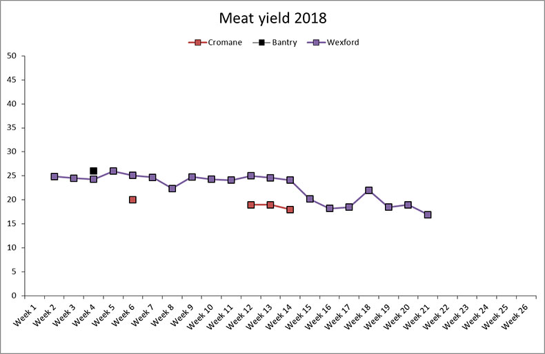
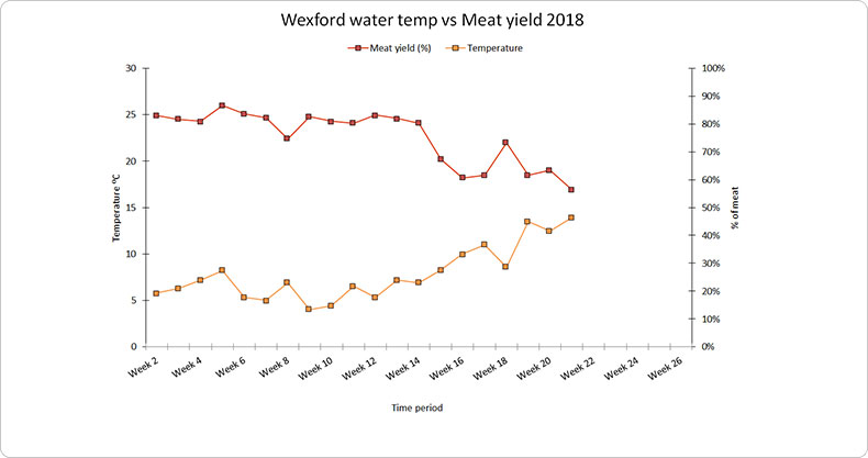
2018
Seed Mussel Survey report for Howth – 11 to 13/09/2018
Seed Mussel Survey Update for the Southeast Coast – September 2018
Seed Mussel Survey Update for the Southeast Coast 21-06-2018 to 27-07-2018
Seed Mussel Survey Report for Cahore Point July 18
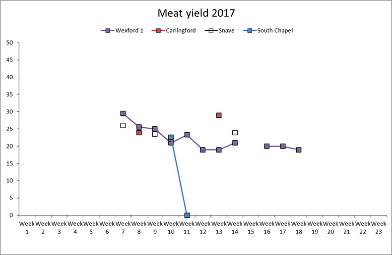
2017
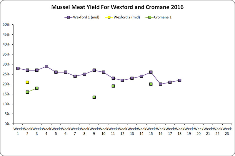
2016
Cromane/Castlemaine Harbour Report
2015
Cromane/Castlemaine Harbour Report
Cromane/Castlemaine Harbour Update
2014
Cromane/Castlemain Harbour Report
2013
Cromane/Castlemaine Harbour Report
2012
Particle Modelling
Menai Dispersal
This model shows particles (mussel larvae) being advected from a source at the Menai mussel farms. Here a very high resolution unstructured mesh model was developed for the Menai Strait and wider Irish Sea. The model resolves the complex tides, eddies, and intertidal regions of the Menai. The tidal residual flow in the Strait is southwestwards, and we can clearly see the particles being advected with the tidal residual. This simulation was repeated throughout the spring neap cycle to see the effect of the tide on dispersal, and ultimately to see where Menai mussels are expected to disperse.
Irish Sea Accumulations
This model shows a grid release of particles (larvae) in the Irish Sea, during April 2014. Here we wanted to show the likely ‘hotspots’ for particle accumulations – and also the ‘particle deserts’, where particles rarely accumulate. We repeated these simulations daily for the entire Apr-Sept season in 2014. This model is driven by the ~200m resolution Irish Sea model developed during ISPP.
Particle Model SW Europe
This model shows cohorts of particles (larvae) release along the European coastline and being advected for 2 weeks. You can see the effects of the strong tidal oscillations in the north (Irish Sea, English Channel) but also the density-driven eddies and gyres in the south. This model is driven by the ~2km resolution IBI Atlantic Area model.


